Tartarus: the Genius Loci, part 2
[This article is also available as a video.]
In Chapter 5 of Nemesis, Miss Marple wonders to herself, “Tour No. 37 of the Famous Houses and Gardens. Why? That is what I have to ask myself. Is it for some geographical or territorial reason?” Her question is one we should also ask: Why? Is Christie centering her mystery around a tour of homes and gardens that she’s numbered “37” for some geographical reason?
The answer is, of course, yes, and this number 37 shows up in a lot of strange places, but one in particular is a geographical place. In the 19th century novel called In Search of the Castaways, Jules Verne writes of an exploration, a tour, if you will, of the 37th parallel south. A parallel is a geographical line of latitude parallel to the equator, and such lines are very different from ley lines because they’re imaginary, a feature of the grid or coordinate system that we use to pinpoint the location of a place on the Earth.
Geography is a way of describing the world that evolved from geometry, and yet, the two systems, as forms of geo-location, are very different. According to the Online Etymology Dictionary the word geometry contains the ancient Greek roots gê, meaning “earth” and μετρία (metría) meaning “measurement.” But geographical maps don’t utilize geometry in the way the ancients did, using measurements drawn out on a plane.
Daniel Azuma, a software engineer at Google Cloud, explains the difference between mapping geographically and geometrically: “Locations on the earth's surface are typically specified using one of two general types of coordinate systems: geographic coordinate systems and projected coordinate systems. Geographic coordinate systems usually use some notion of latitude and longitude, measuring angles along the surface of the earth. They are also embedded in a curved domain. What this means is, you can't technically show latitude and longitude on a flat piece of paper or computer screen. Objects described in latitude and longitude are always curved like the surface of the earth; distances measured between latitudes and longitudes are always measured along a curved surface.”
In the late 19th century, Jules Verne invented the genre of the geographical novel, and it’s in Castaways that we find a connection to the geographic importance of the number 37. In this story, Lord and Lady Glenarvan, along with two children, Mary and Robert Grant, set off to find the childrens’ shipwrecked father, Captain Grant, who’s lost at sea. [For more information on the meaning of being “lost at sea,” please check out my other videos on Admiralty Law on Prime Time and the Deceptive Maritime Flow of Money or Cash Into Water.]
All they know about the captain’s current location is from a fragment of a note in a bottle, giving a coordinate of 37 degrees south latitude. Verne’s book, following the “rigorously straight line” of the 37th parallel, is clearly one of his “geographical” novels, but the subtext might cause us to question what Verne is actually saying about the science of geography.
The foil of the story, contrasted against the successful Lord Glenarvan, is its expert geographer, Jacques Paganel, whose absent-mindedness causes several problems for the search party. In Disney’s film adapatation of the novel, Paganel repeatedly calls himself “stupid,” and Glenarvan tells us that Paganel is well known for his blunders: “He once published a celebrated map of America, in which he located Japan. However, he is a distinguished scholar, and one of the best geographers of France.” As such, Paganel keeps thwarting the progress of the search party in reaching their destination, though admittedly, because they only have one coordinate from the note in the bottle, they don’t know what their destination actually is.
Despite the fact that his geographical expertise brings little value to the expedition, Paganel is determined to teach geography to the two boys in the story: Robert Grant and a boy named Toliné, who’s found sleeping in a cemetery and assumed to be an orphan. Robert has also been orphaned, at least temporarily, by his father’s shipwreck. However, neither boy is really an orphan. It turns out that Toliné was returning to his family after being away at school where he had taken “the first prize in geography.” Of course, Paganel is all over that, and he tests the child’s geographical knowledge “greatly.”
But there’s a repeating motif here of teaching geography to the young. At first glance, this doesn’t seem surprising; we usually teach things to the young. But there’s more to it.
Both Nemesis and Castaways are stories with a subliminal subtext regarding the young. In fact, the original title of Castaways was The Children of Captain Grant, telling us that the story is more about the temporarily orphaned kids, Robert and Mary, than about their lost father. It’s about the children’s adventures and their challenges along the way. What’s particularly interesting, though, is how young Robert responds to those challenges.
Similar to Christie’s Nemesis, in which the young Emlyn Price is portrayed as Tour 37’s pro-valley “an-archist” (in opposition to the arch and/or the hill), who’s suspected for a time of killing Miss Temple on the monument’s hill, the young Robert Grant has similar experiences with respect to high and low points of land. He’s not suspected of murder, but he does encounter dangers at altitude.
During an earthquake high in the Andes mountains, the search party is caught in a landslide. Just as Elizabeth Temple did in Nemesis, they experience danger on a high point of land, and when the party falls down the slope, young Robert goes missing in what Verne calls the “fatal valley.” He describes it this way because everyone in the search party now fears Robert is dead in either the valley, itself, or maybe a deeper crevasse. The valley hasn’t been fatal to Robert and he’s eventually found, but the experience highlights the fact that the adults express a bias, a preference for high points of land, despite their inherent dangers.
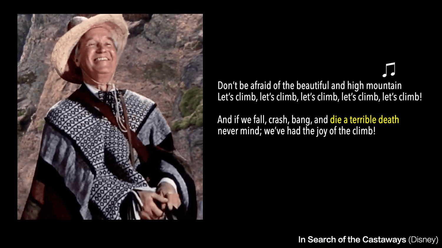
This is shown explicitly in the Disney adaptation, where Paganel leads the search party into the Andes singing, “let’s climb, let’s climb, let’s climb…” even if it means they’ll die:
“Don’t be afraid of the beautiful and high mountain… Let’s climb (x5)
And if we fall, crash, bang, and die a terrible death,
Never mind; we’ve had the joy of the climb!”
In Verne’s novel, there’s no song, but it’s still Paganel who urges them upward:
‘We will follow you,” replied Tom Austin.
“And even precede you,” added Paganel. “What is it, after all? To scale a chain of mountains whose opposite slopes afford an unusually easy descent… Forward, then, without hesitation.”
Of course, pushing everyone to “climb!” is one of Paganel’s many blunders, as he leads them up to a dangerous area prone to earthquakes. But while Paganel is pro-mountain, it’s the young an-archists, characters like Emlyn Price and Robert Grant, who find comparable safety in the hill’s opposite: the valley.
Verne gives us the same high/low dichotomy when the search party reaches New Zealand. This leg of the story starts in Chapter 49, when they encounter the Maori tribe and Glenarvan, defending his wife, kills the tribal king. The tribe then imprisons the search party in a temple hut on a high mountain, planning to execute them the following morning.
Young Robert, however, slips away from the search party before they’re led up to the temple and is never imprisoned. He’s able to free the search party from the temple by digging them out through a hole in the floor and leading them down a cliff wall: “I have discovered at the base of the slope a sort of deep excavation, where those who descend first can wait for the others in safety.” Robert is expressing his youthful an-archism by successfully leading everyone down into a valley, away from the danger of the elevated temple.
But as they descend, the Maori tribe spot them and drive them back up. For days, the search party is trapped on top of the mountain, unable to descend to safety.
Because the valley isn’t now accessible, they must “dig deeper,” so to speak, and in Chapter 53, they devise a plan. Paganel realizes that they’re trapped on top of a mountain, an old volcano, with small, subterranean fires just below the surface. They dig a crater to stage a mock volcanic eruption. “This rocky mass covered a small natural crater in the peak, and only by its weight prevented the escape of the subterranean flames. If they could succeed in overturning it, the smoke and lava would immediately issue through the unobstructed opening.” When the lava descends down on the Maori tribe, a way of escaping the mountain is now open to them. They’ve effectively tapped the valley, the fiery volcanic pit of Tartarus, to save themselves from the danger of the high land.
But this isn’t just a dichotomy between high and low plateaus of land; it’s a dichotomy of the convex arc or arch and the concave pit.
The convex arc also shows up in the lines of latitude, which are curved, but also straight, and even parallel, and Jules Verne gives us a contrasting dichotomy in the scene with Toliné, who being shipped home by train as a parcel of mail—a common custom in the 19th century—with a note pinned to his coat that read “prepaid.” However, this train derails, which is is why he was sleeping outside. At this time, the late 1800s, trains were the modern method of mass travel across the earth’s surface, using two parallel steel rails, echoing the geographical parallel the search party is following. But something has gone wrong: “A terrible accident had occurred, not a collision, but a running off the track and a fall into the river, which was filled with the fragments of cars and locomotives. Either the bridge had given way, or the engine had run off the track; for five coaches out of six had been precipitated into the bed of the Lutton. The last car, miraculously preserved by the breaking of its coupling, stood on the very verge of the abyss.” Here, we can see the parallel lines of the track turning down into the ravine below the bridge, forming the downward, concave inversion of the arc.
The derailed train reflects the search party’s own problem; they’re also following a parallel line, but though that line is a convex arc over the earth’s surface, they must repeatedly descend a concave line downward to escape catastrophe. Admittedly, these are the kind of catastrophes that make for good novels and good Disney films, but the subtext in Castaways is that the study of geography doesn’t really seem to help the search party reach their destination. Or maybe it’s more accurate to say that parallel, convex lines don’t help reunite orphans with parents.
In Nemesis, “anarchism” is code for the valley, the field, the pit, Tartarus or Tartaros, the partner of Nemesis, herself. The arc/arch and hill for both authors is the terrain of the ruling class, the parent, the expert, while the valley is the terrain of the poor, the young, the orphan, the commoner.
Robert saves, first, himself, then the search party in the valley. Toliné survives the parallel tracks curving down, concave, into the abyss. The underlying message seems to be, let the youth, especially those with poor parents or no parents at all, be heroic in the lowlands, in the soil, toiling in the fields to grow the food and dig the metals, or fighting in the fields to pillage the food and metals of others. The young should work the land, not inherit the land.
Meanwhile, the rulers and the adults will quietly keep to the real “safety” of the mountains, tending to the temples and monuments that produce no food or useful goods, while they assure the young (through popular fiction) that the high lands are dangerous and the low lands are safe. Verne was the perfect author to send this message as the target audience for his geographical novels were young boys curious about the world.
But this goes for girls, too. Lord Glenarvan married his wife when he “found” Helena living as an orphan: “He found her one day living alone, an orphan, almost without fortune, in the house of her father at Kilpatrick. He saw that the poor girl would make a noble wife, and he married her.” Her marriage moved her from the town, located at the foot of the Kilpatrick Hills into a hilltop castle overlooking a valley: “The castle of Malcolm, one of the most romantic in Scotland, is situated near the village of Luss, whose pretty valley it crowns.” So Helena graduated from child orphan to an elite, castle-dwelling wife, and her short story was told in the altitude change of the land she inhabited.
The years 1837 and 1853
All the search party knows regarding the location of Captain Grant’s shipwreck is that it occurred at 37 degrees latitude, so they follow that line in their search for him. Eventually, they’ll learn the other coordinate, 153 degrees longitude and you may recognize 37 and 53 as masonic numbers.
In the 37th chapter of Castaways, the natural world is suddenly likened to symmetrical Greco Roman architecture, the “interminable arches” of Australian eucalyptus trees that resemble pillars or Roman columns:
“They [the trees] were like so many columns exactly mated, and could be, counted by hundreds, spreading at a vast height into capitals of finely-shaped branches adorned with vertical leaves… All day long our travelers pursued their way under these interminable arches.”
Miss Marple’s much later Tour 37 of homes and gardens, or architecture and outdoor landscape, is an echo of Jules Verne’s imagery of the 37th parallel: melding trees into columns, an outdoor landscape morphing into architecture.
Columns are often used to support the arch, the interminable arches, and when Jules Verne likens trees to Roman columns, we’re seeing masonic symbolism from a masonic author. The two columns of freemasonry are called Joachim and Boaz, and refer back to the pillars of Solomon’s Temple. (In this video, I covered Kubrick’s handling of this same symbol throughout the movie The Shining.)
Once the search party exits the Roman columns of trees, they walk into the village of Seymour, still on the 37th parallel, a place that’s “a simple parish that would like to become a municipality.”
Wikipedia defines a municipality this way: “In ancient Rome, the Latin term municipium referred to a town or city. Etymologically, the municipium was a social contract among municipes ('duty holders'), or citizens of the town. The duties (munera) were a communal obligation assumed by the municipes in exchange for the privileges and protections of citizenship. Every citizen was a municeps.”
What is the duty that citizens owe? Other than taxes, the primary “call of duty” is military duty. And this is a duty we sort of have backward. As citizens, we’re programmed to think that military protection is a benefit of citizenship, but it’s really the other way around. Military duty is the cost of citizenship. The able-bodied young have a duty placed upon them to serve in the military—they are duty bound to serve—and if the government’s incentives don’t draw in enough young people, the young will be drafted, forced to pay this “duty.”
Several decades after Jules Verne described Seymour, Australia as wanting to become a municipality, Puckapunyal army base was built just outside Seymour on the 37th parallel. The town of Seymour was named for Lord Seymour, the son of the 11th Duke of Somerset, and here we find a few more buried details linking Castaways to Agatha Christie’s Nemesis.
The Seymour family is the second family to hold the title Duke of Somerset, a title that’s connected with two “houses,” both called “Somerset House,” and this word, alone, echoes Tour 37 of the Famous Houses and Gardens of Great Britain (even though, in the BBC version, it reads Homes).
The first Somerset House was a town house in Mayfair once occupied by the 11th Duke of Somerset, Edward Adolphus Seymour. His son, for whom Seymour, Australia was named, left this house to his daughter, who sold it before it was demolished in 1915, to be replaced by an apartment building of “flats” designed by the architect named Frank Verity. In fact, Frank and his father, Thomas Verity, were both architects, taking us back to the concept of architecture, and the “arch.”
The Verity family included several architects, including Terence Verity, Frank’s nephew, and even Oliver Hill, “celebrated for designing the British Pavilion at the Paris Exposition of 1937 and for his grand country houses.”
Notice that Thomas was born in 1837 and his son, Frank, died in 1937. Thomas was 53 years old when he died, as was his grandson Terence Verity… a series of masonic numerological coincidences.
The other Somerset House is more well known as a government office building, but the site originally held a Tudor palace. It was rebuilt and became a government or “Publick” office in 1775. Military offices there included the Navy Office and the Office of Ordnance. It also housed “learned societies” like the Royal Society.
The Royal College of Art (originally called the Government School of Design) was located at Somerset House from 1837 to 1853, two very masonic numbers. It was replaced, in 1853, by the Registry of Births, Marriages, and Deaths. Coincidentally, civil registration of births first began in England in 1837. Again, a series of masonic numerological coincidences.
Somerset as a place—a genius loci—is mentioned once in Nemesis, here: “They discussed the many tours they had been on… and finally the County of Somerset where Miss Lumley and Miss Bentham lived, and where the difficulties of getting suitable gardeners could hardly be believed.” This was referring to the fact that, during World War I, the Somerset Light Infantry suffered nearly 5,000 casualties. According to Wikipedia, “War memorials were put up in most of [Somerset] county's towns and villages.” Recall that Anthea Bradbury-Scott expressed the same problem: “[D]uring the war one could not get any gardeners. We had a very young gardener and then he was called up. One does not of course grudge that…” Again, war was considered the duty of the young and not something Anthea should be complaining about. She had, after all, inherited the Old Manor House precisely because the young, rightful heir was killed in war.
In Castaways, the search party had the necessary information to find Captain Grant all along, but not in the form of coordinates. The partial note in the bottle contained most of the name of the island that he was shipwrecked on, a name missed by everyone in the search, including the expert geographer, Paganel. So when they finally find him, it’s a complete accident.
Captain Grant tells the search party that he wrote the island’s name, Tabor, on the note in the bottle. But Paganel thinks this particular island is called something else.
Paganel then asks him, “How Tabor Island? It is Maria Theresa.”
Grant responds, “Maria Theresa on the English and German, but Tabor on the French maps.” His crew mates then berate Paganel, saying, “A fine geographer you are!”
So what is Jules Verne telling us, in this “geographical” novel in which geography fails to locate the castaways?
The underlying message here is the necessity of having both a place and a name, an echo of the legal cases of Coke and Bacon that we looked at in Part I. In the case of Marriot v. Pascall, the hospital’s lease used a name that failed to designate, in “certainty,” the corporation’s physical location. Here in Castaways, the name on a note, Tabor, also fails to designate the physical location of Captain Grant.
The same issue comes up in the Case of Sutton’s Hospital, where Bacon argued for the necessity of both a corporate name and place, because “…a place by a known name is not sufficient to support the name of an Incorporation, but the same ought to be described by metes and bounds…” On the small scale,“metes and bounds” are no different than geographical coordinates on the large scale, and Bacon was arguing that corporate law should require both. Hundreds of years later, Jules Verne reiterates the same truth, that name, alone, isn’t always enough, placing a higher importance on place and its coordinates of measure.
Don’t forget that the connection between both stories, focused on young anarchists and orphans, is a geographical 37. And this number also comes up, along with an occasional 53, in the history of orphan handling in the U.S. For example, the Children’s Aid Society was formed in 1853, a man named Charles Loring Brace served as its executive secretary for 37 years, and its first shipment of children, sent to Michigan, successfully placed 37 orphans… nice, neat, masonic numbers. Recall the noteworthy parallel that the Civil Registry for births in England began in 1837 and that the Registry for births moved to Somerset House in 1853… masonic numbers connected to a government office recording which births were heirs, growing up on heritable land, and which births were orphans.
Charles Loring Brace formed the Children’s Aid Society because he was appalled at the number of orphans living on the streets of New York City. According to Wikipedia, “The only options available to such children at the time were begging, prostitution, petty thievery, and gang membership, or commitment to jails, almshouses, and orphanages.” You might think the obvious solution would, in fact, be the orphanages mentioned, but Brace had another idea. He wanted to ship orphans into the midwest as slave labor. This project became known as the Orphan Trains, and in her book, The Orphan Trains, Marilyn Holt reported that the children were usually placed or adopted out as farm labor: “Charles Loring Brace… had resolved to make use… of the endless demand for children’s labor in the Western country.” Martha Ulman also cites Mary Ann Mason, writing, “labor was still the main attraction for prospective families in the early days of placing out.”
We can see from this disclaimer put out by the Children’s Aid Society that the restrictions used on the children are similar to those of cults, today: “Children are not allowed to correspond with any friends or relatives without obtaining permission to do so from the Society.”
But perhaps this cult-like organization selling orphans as farm labor wasn’t any worse than what the orphanages were doing. This is a photo from the Louisville, Kentucky Masonic Widows and Orphans Home, built by the Olmsted Brothers in the 1920s.
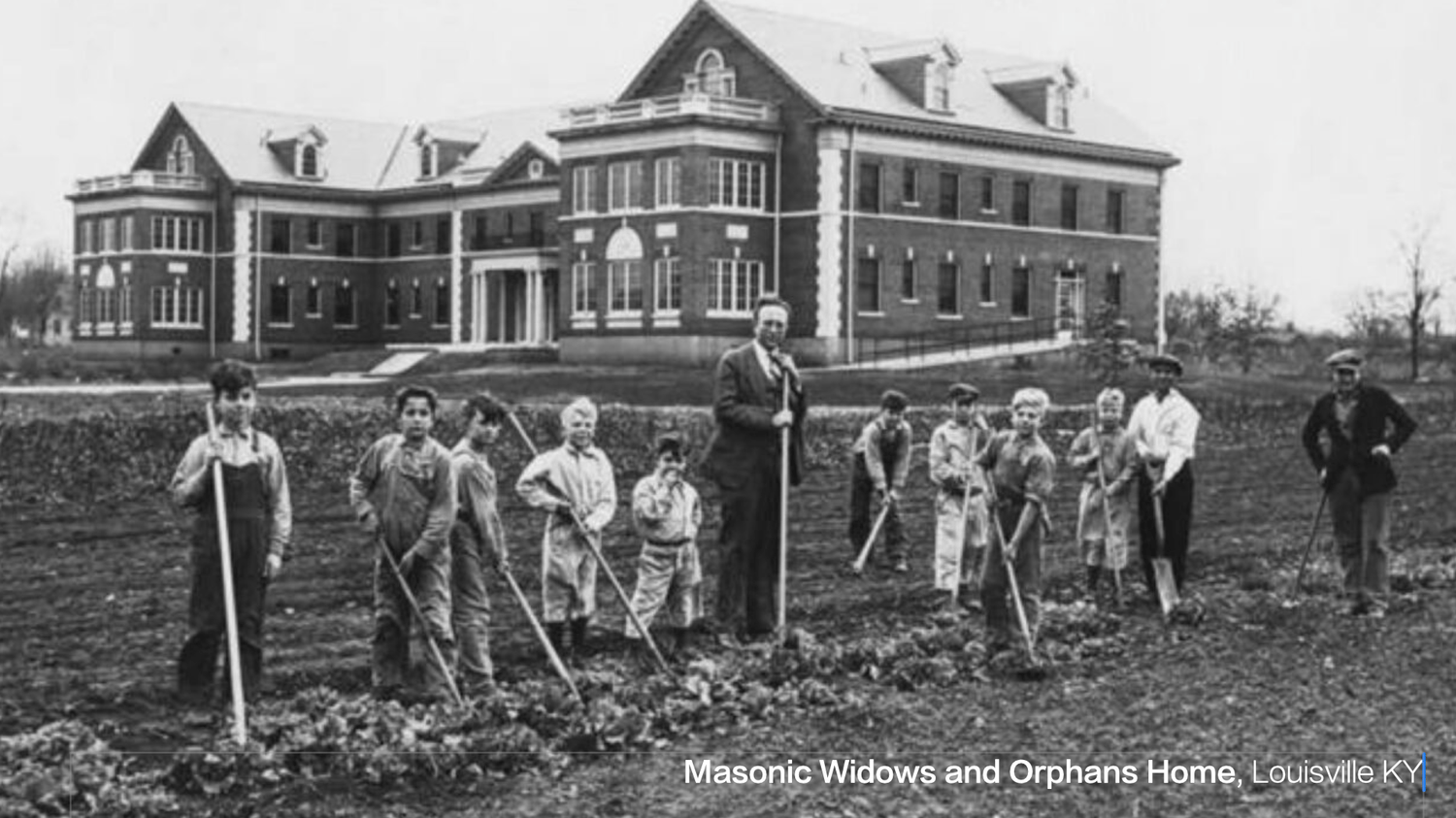
The Olmsted landscape and architectural firm was founded by Frederick Law Olmsted, who designed the landscapes for sites like New York City’s Central Park. His firm passed to his sons and would later design masonic places like the George Washington Masonic National Memorial, atop Shuters Hill in Alexandria, Virginia: another memorial located on a hill, a high point of land.
Frederick Law Olmsted as a landscape architect placed high design importance on the genius loci. In fact, Olmsted’s biography was entitled Genius of Place. And Olmsted turns out to have been a lifelong friend, from childhood, of Charles Loring Brace.
In 1853, Olmsted was commissioned to travel throughout the American south, which happens to be an area defined by its northern boundary: the 37th parallel. It’s interesting to note that Olmsted, Illinois, a town founded just 20 years later, sits on the 37th parallel. And though the mainstream narrative denies a connection between the landscape architect and the town, according to Michelle Gibson’s research, Olmsted studied surveying in his youth, making a connection not only possible but likely.
Oh, and Olmsted, Illinois also sits on Illinois Route 37.
The masonic numbers 37 and 53 feature prominently in the timelines of both Brace and Olmsted, and Charles Loring Brace provides a further connection, through his work with orphans, to the British Registry of Births, with start-up dates featuring the same masonic numbers. But the fact that the Verity family of architects connect back to the Registry’s location at Somerset House makes me wonder if Agatha Christie’s clues in Nemesis were pointing to something much larger, with all its commentary on young anarchists and young gardeners being called up for war.
xxx
xxxxx


Stephanie McPeak Petersen
Join me on deep dives into Shakespeare, Francis Bacon, harmonics, economics, and hidden history.


My husband Allan's website:
Stay connected with my updates delivered straight to your inbox.